

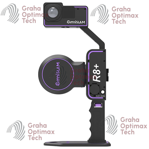
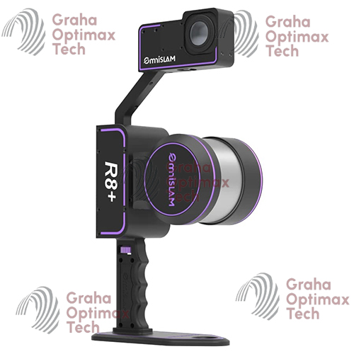
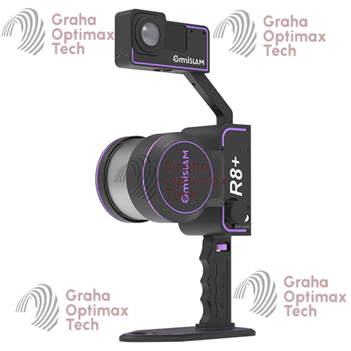
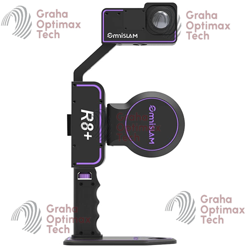
OmniSLAM R8+ 3D Mapping System
Original price was: $18.300.$9.650Current price is: $9.650.
The OmniSLAM R8+ 3D Mapping System is a professional mobile LiDAR scanner featuring advanced SLAM positioning, real-time point cloud generation, panoramic imaging, and high-speed reality capture for surveying, BIM, mining, and infrastructure applications.
Description
OmniSLAM R8+ 3D Mapping System
Introduction to the OmniSLAM R8+ 3D Mapping System
The OmniSLAM R8+ is a professional-grade mobile 3D mapping system engineered for high-precision reality capture, SLAM-based positioning, LiDAR scanning, and rapid digital twin generation. Designed for surveying professionals, geospatial engineers, construction companies, mining operations, BIM specialists, and infrastructure inspection teams, the OmniSLAM R8+ combines advanced LiDAR sensors, real-time SLAM algorithms, IMU integration, and panoramic imaging technology into a compact portable platform.
Built for indoor and outdoor environments, the OmniSLAM R8+ delivers fast and accurate point cloud acquisition without requiring GNSS availability at all times. The system is optimized for complex environments such as tunnels, industrial plants, underground facilities, urban corridors, construction sites, forests, and large-scale infrastructure projects.
What is the OmniSLAM R8+?
Advanced SLAM-Based Mobile Mapping Technology
The OmniSLAM R8+ uses Simultaneous Localization and Mapping (SLAM) technology to generate accurate 3D spatial data while moving through an environment. Unlike traditional static laser scanners that require multiple setup stations, the R8+ captures continuous spatial information in real time.
Key Capabilities
- Real-time 3D mapping
- High-density point cloud generation
- Indoor and outdoor scanning
- GNSS-denied environment operation
- Digital twin creation
- BIM-compatible data output
- Portable handheld mapping workflow
- Vehicle and backpack integration support
Main Features of the OmniSLAM R8+
High-Performance LiDAR Sensor
The OmniSLAM R8+ integrates a high-speed laser scanning engine capable of generating millions of measurement points for dense and highly detailed 3D environments.
Benefits
- High point cloud density
- Accurate geometry reconstruction
- Improved object recognition
- Enhanced feature extraction
- Faster project completion
Advanced SLAM Algorithm Engine
Intelligent Positioning System
The integrated SLAM engine continuously calculates position and orientation using LiDAR, IMU, and sensor fusion technologies.
Advantages
- Stable trajectory estimation
- Reduced drift errors
- High mapping reliability
- Accurate corridor mapping
- Smooth indoor-outdoor transitions
Real-Time Data Visualization
The OmniSLAM R8+ allows operators to visualize scanning progress in real time through connected software interfaces.
Real-Time Workflow Benefits
- Immediate quality control
- Faster field verification
- Reduced rescanning requirements
- Improved survey efficiency
OmniSLAM R8+ Applications
Surveying and Geospatial Mapping
The OmniSLAM R8+ is suitable for:
- Topographic surveys
- Utility corridor mapping
- Road surveys
- Railway mapping
- GIS data collection
- Urban modeling
- Terrain documentation
Construction and BIM
Construction Applications
- As-built verification
- BIM modeling
- Progress monitoring
- Structural documentation
- MEP verification
- Clash detection workflows
BIM Integration
The system supports point cloud exports compatible with leading BIM software platforms.
Mining and Underground Mapping
The OmniSLAM R8+ performs exceptionally well in GNSS-denied environments.
Mining Use Cases
- Underground tunnel mapping
- Shaft documentation
- Stockpile measurement
- Geological inspection
- Mine infrastructure surveys
Industrial Facility Scanning
Industrial Applications
- Plant documentation
- Refinery mapping
- Factory digitization
- Equipment positioning
- Asset management
- Maintenance planning
Specifications of OmniSLAM R8+
LiDAR Specifications
| Specification | Value |
|---|---|
| Scanning Technology | LiDAR SLAM |
| Laser Type | Multi-line LiDAR |
| Point Cloud Output | High-density |
| Scan Coverage | 360° Horizontal |
| Vertical Field of View | Wide-angle |
| Real-Time Mapping | Supported |
| Maximum Mapping Speed | High-speed mobile capture |
Accuracy Specifications
| Specification | Value |
|---|---|
| Relative Accuracy | Up to centimeter-level |
| Absolute Accuracy | Dependent on control workflow |
| SLAM Drift Control | Advanced sensor fusion |
| Repeatability | High-precision repeatable mapping |
Accuracy Optimization Features
- IMU-assisted stabilization
- Loop closure correction
- Trajectory optimization
- GNSS integration support
- Control point adjustment compatibility
Positioning and Navigation System
| Specification | Value |
|---|---|
| SLAM Technology | Simultaneous Localization and Mapping |
| IMU Integration | Yes |
| GNSS Support | Optional / supported |
| Indoor Navigation | Supported |
| Outdoor Navigation | Supported |
| Hybrid Positioning | Available |
Camera and Imaging System
Integrated Imaging Features
| Specification | Value |
|---|---|
| Panoramic Camera | Supported |
| RGB Colorization | Supported |
| Image Synchronization | Real-time |
| Texture Mapping | Supported |
Imaging Benefits
- Colorized point clouds
- Improved visual documentation
- Enhanced inspection workflows
- Better digital twin visualization
System Performance Specifications
| Specification | Value |
|---|---|
| Startup Time | Fast boot |
| Real-Time Preview | Yes |
| Data Storage | High-capacity internal storage |
| Export Formats | LAS, PLY, XYZ, E57 |
| Processing Compatibility | Major point cloud software |
Physical Specifications
| Specification | Value |
|---|---|
| System Design | Portable handheld |
| Weight | Lightweight field design |
| Mobility | Backpack and handheld compatible |
| Construction | Rugged industrial housing |
Environmental Specifications
| Specification | Value |
|---|---|
| Outdoor Operation | Yes |
| Indoor Operation | Yes |
| Operating Temperature | Industrial-grade range |
| Rugged Protection | Field-ready design |
OmniSLAM R8+ Workflow
Step 1 – System Initialization
The operator powers on the device and initializes the SLAM environment.
Initialization Includes
- Sensor calibration
- IMU stabilization
- LiDAR startup
- GNSS synchronization (if enabled)
Step 2 – Mobile Data Collection
The user walks or moves through the project environment while the system continuously captures spatial data.
Mapping Methods
- Handheld scanning
- Backpack mapping
- Vehicle-mounted operation
- Indoor corridor mapping
Step 3 – Real-Time Monitoring
Operators monitor trajectory quality and point cloud coverage through field software.
Monitoring Benefits
- Coverage verification
- Missing area detection
- Scan quality control
Step 4 – Point Cloud Processing
Collected data is processed into a final deliverable point cloud.
Final Deliverables
- Colorized point clouds
- 3D models
- BIM datasets
- CAD-compatible outputs
- Digital twin environments
Advantages of OmniSLAM R8+
Faster Than Traditional Static Scanning
Traditional terrestrial laser scanning often requires multiple setups and targets. The OmniSLAM R8+ significantly reduces field time through continuous motion scanning.
Productivity Advantages
- Faster site coverage
- Reduced labor requirements
- Lower project costs
- Increased operational efficiency
Superior Indoor Mapping Capability
The SLAM engine enables highly efficient indoor mapping without GNSS dependence.
Ideal Indoor Environments
- Airports
- Hospitals
- Shopping centers
- Warehouses
- Industrial facilities
- Underground infrastructure
Flexible Deployment Options
The OmniSLAM R8+ can adapt to multiple operational workflows.
Supported Configurations
- Handheld operation
- Backpack mapping
- Vehicle platform integration
- Robotic platform support
Software Compatibility
Supported Processing Platforms
The OmniSLAM R8+ supports integration with major geospatial and BIM software ecosystems.
Compatible Platforms
- Autodesk ReCap
- Autodesk Revit
- Bentley ContextCapture
- Trimble RealWorks
- CloudCompare
- ArcGIS
- Leica Cyclone
- Pix4D
Industries Using OmniSLAM R8+
Construction Industry
- Building documentation
- Site monitoring
- Structural verification
- Infrastructure development
Surveying Industry
- Geospatial mapping
- Utility surveys
- Transportation corridors
- GIS documentation
Mining Industry
- Underground scanning
- Tunnel inspection
- Asset mapping
- Geological analysis
Public Infrastructure
- Railway inspection
- Highway mapping
- Smart city development
- Utility infrastructure documentation
OmniSLAM R8+ vs Traditional Laser Scanners
| Feature | OmniSLAM R8+ | Traditional Laser Scanner |
|---|---|---|
| Mobile Scanning | Yes | Limited |
| SLAM Positioning | Yes | No |
| Continuous Mapping | Yes | No |
| Setup Time | Minimal | High |
| Indoor Mapping | Excellent | Moderate |
| Workflow Speed | Very Fast | Slower |
| Real-Time Preview | Yes | Limited |
Data Output and Deliverables
Standard Deliverables
The OmniSLAM R8+ supports professional survey-grade outputs.
Export Options
- LAS
- LAZ
- E57
- PLY
- XYZ
- OBJ
- BIM-compatible point clouds
Brand
OmniSLAM
Related products
-
-
- Sale!
- 3D Scanner, Surveying Equipment
Leica BLK2GO Handheld Imaging Laser Scanner
- Original price was: $12.100.$7.980Current price is: $7.980.
- Add to cart
-


Reviews
There are no reviews yet.