
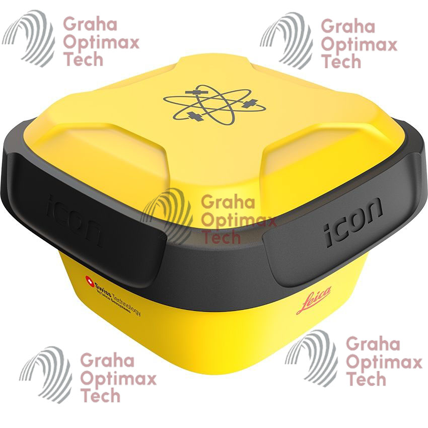
Leica iCON 80 Smart GNSS
Original price was: $11.200.$5.700Current price is: $5.700.
Leica iCON 80 Smart GNSS is a professional GNSS RTK receiver designed for construction layout, surveying, machine control, and GIS mapping with advanced tilt compensation and multi-constellation satellite tracking.
Description
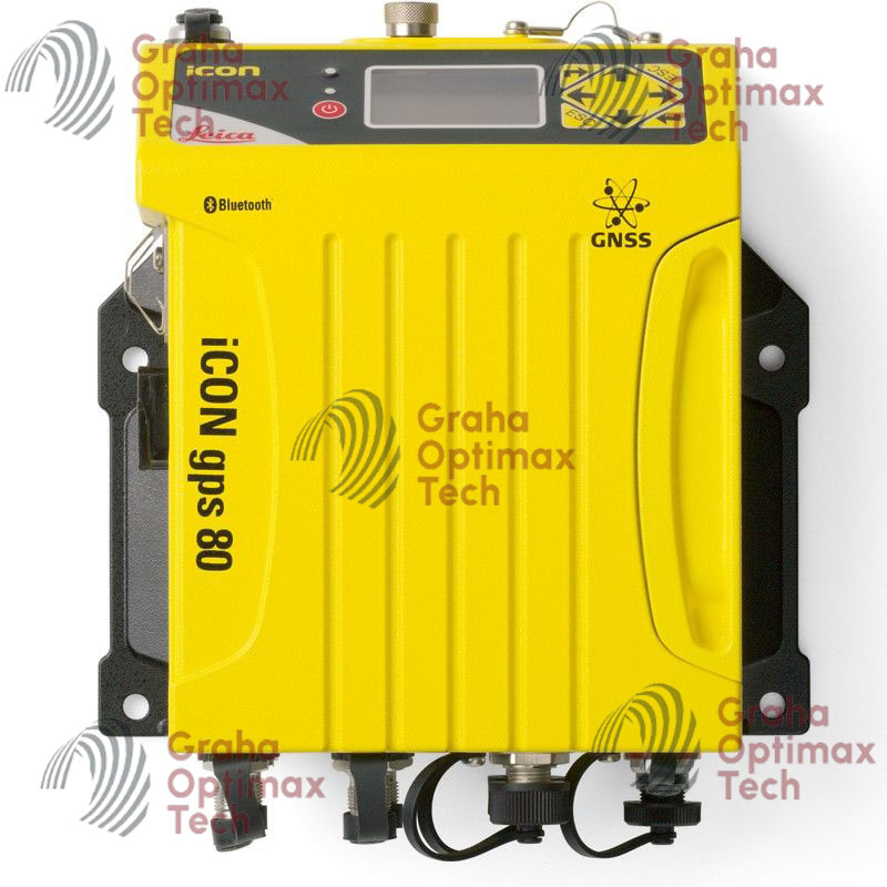
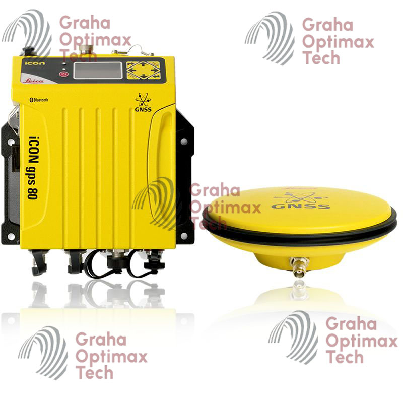
Leica iCON 80 Smart GNSS
Advanced Smart GNSS Receiver for Construction, Surveying, and Machine Control
The Leica iCON 80 Smart GNSS is a professional-grade GNSS positioning solution designed to deliver precise RTK accuracy, intelligent construction workflows, and reliable field performance. Engineered by Leica Geosystems, the iCON 80 Smart GNSS combines advanced multi-frequency satellite tracking, IMU-based tilt compensation, rugged durability, and seamless wireless connectivity to support demanding surveying and construction applications.
Built specifically for modern construction environments, the Leica iCON 80 enables contractors, surveyors, civil engineers, and machine operators to improve productivity, reduce setup time, and achieve highly accurate positioning results in challenging jobsite conditions.
Why Choose Leica iCON 80 Smart GNSS
Optimized for Construction and Surveying Workflows
The Leica iCON 80 Smart GNSS is designed to streamline field operations with advanced positioning technology and intuitive usability.
Key Benefits
- High-precision RTK positioning
- Fast satellite acquisition
- Reliable IMU tilt compensation
- Rugged construction-ready design
- Long battery operation
- Seamless machine control integration
- Efficient wireless communication
Advanced Multi-Constellation GNSS Technology
Superior Satellite Tracking Performance
The Leica iCON 80 supports simultaneous tracking of multiple satellite constellations and frequencies to ensure stable positioning performance in difficult environments.
Supported Satellite Systems
- GPS
- GLONASS
- Galileo
- BeiDou
- QZSS
- SBAS
Supported GNSS Frequencies
| GNSS Constellation | Supported Signals |
|---|---|
| GPS | L1, L2, L5 |
| GLONASS | G1, G2 |
| Galileo | E1, E5a, E5b |
| BeiDou | B1, B2, B3 |
| QZSS | L1, L2, L5 |
Leica iCON 80 RTK Accuracy
High-Precision Positioning for Professional Applications
The receiver provides reliable centimeter-level RTK accuracy for construction layout, topographic surveys, and machine guidance applications.
Accuracy Specifications
| Measurement Type | Accuracy |
|---|---|
| RTK Horizontal Accuracy | 8 mm + 1 ppm |
| RTK Vertical Accuracy | 15 mm + 1 ppm |
| Static Horizontal Accuracy | 2.5 mm + 0.5 ppm |
| Static Vertical Accuracy | 5 mm + 0.5 ppm |
| DGPS Accuracy | <0.4 m RMS |
| Initialization Time | Typically <10 seconds |
| Signal Reacquisition | <1 second |
Advanced IMU Tilt Compensation
Faster Surveying Without Pole Leveling
The Leica iCON 80 Smart GNSS features advanced inertial measurement technology that enables accurate measurements without maintaining a perfectly vertical survey pole.
Tilt Compensation Advantages
- Faster field data collection
- Increased productivity
- Easier access to difficult points
- Improved operator safety
- Reduced field fatigue
Tilt Specifications
| Feature | Specification |
|---|---|
| Tilt Technology | IMU-based |
| Maximum Tilt Angle | Up to 60° |
| Calibration | Automatic |
| Magnetic Dependency | Minimal |
Rugged Industrial Design
Built for Extreme Construction Environments
The Leica iCON 80 is engineered for reliable operation in harsh outdoor conditions and demanding construction sites.
Rugged Features
- Waterproof housing
- Dustproof protection
- Shock-resistant construction
- Corrosion-resistant materials
- Heavy-duty industrial design
Environmental Specifications
| Parameter | Specification |
|---|---|
| IP Protection Rating | IP67 |
| Operating Temperature | -40°C to +65°C |
| Storage Temperature | -40°C to +85°C |
| Humidity Resistance | 100% condensing |
| Pole Drop Resistance | 2 m |
Wireless Connectivity and Data Communication
Smart Communication Technology
The Leica iCON 80 supports multiple wireless communication options for reliable RTK correction delivery and field data exchange.
Connectivity Features
- Bluetooth
- Wi-Fi
- 4G LTE cellular modem
- Internal UHF radio
- USB Type-C
- Serial communication
Supported Correction Formats
- RTCM 2.x
- RTCM 3.x
- CMR
- CMR+
- NTRIP Client
- NTRIP Server
Long Battery Performance
Designed for Full-Day Field Operations
The receiver includes a high-capacity battery system optimized for continuous operation during demanding fieldwork.
Battery Features
- Internal rechargeable Li-Ion battery
- Intelligent power management
- Fast charging capability
- External power compatibility
Battery Specifications
| Feature | Details |
|---|---|
| Battery Type | Li-Ion rechargeable |
| Operating Time | Up to 14–16 hours |
| Charging Time | Approx. 4 hours |
| External Power Support | Yes |
Leica iCON 80 Smart GNSS Applications
Construction Layout and Staking
The Leica iCON 80 is ideal for:
- Site layout
- Foundation staking
- Utility positioning
- Grade checking
- Earthworks
- Road construction
Surveying Applications
The GNSS receiver supports:
- Topographic surveys
- Boundary surveys
- Control point establishment
- As-built documentation
- Infrastructure surveys
Machine Control Applications
The receiver integrates with Leica machine control systems for:
- Excavator guidance
- Dozer control
- Road paving
- Construction automation
- Real-time machine positioning
GIS and Infrastructure Mapping
The Leica iCON 80 also supports:
- GIS data collection
- Asset mapping
- Utility surveys
- Municipal infrastructure projects
- Environmental monitoring
Leica iCON 80 Smart GNSS Technical Specifications
GNSS Engine Specifications
| Specification | Details |
|---|---|
| GNSS Channels | 800+ channels |
| Multi-Constellation Support | Yes |
| Multi-Frequency Tracking | Yes |
| RTK Engine | Advanced Leica RTK |
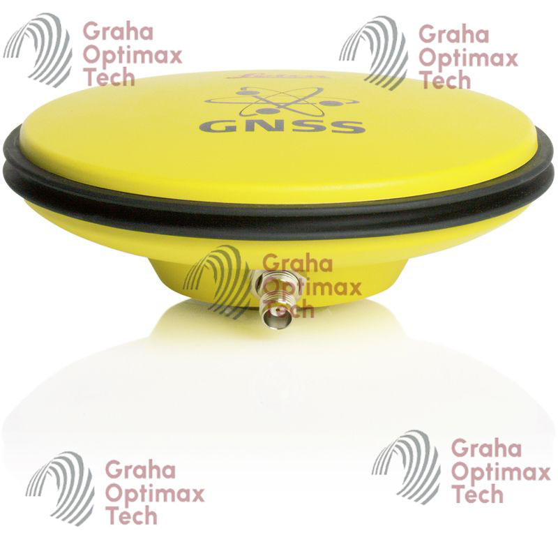
Physical Specifications
| Feature | Details |
|---|---|
| Weight | Approx. 1.1–1.3 kg |
| Housing Material | Magnesium alloy + industrial polymer |
| Mounting Thread | 5/8-inch survey thread |
| Form Factor | Compact smart antenna |
Communication Specifications
| Feature | Details |
|---|---|
| Bluetooth Version | Bluetooth 5.0 |
| Wi-Fi Connectivity | Integrated |
| Cellular Modem | 4G LTE |
| UHF Radio | Optional Tx/Rx |
| Internal Storage | Supported |
Integrated Sensors and Features
| Feature | Availability |
|---|---|
| IMU Tilt Sensor | Yes |
| Electronic Bubble | Yes |
| NFC Pairing | Supported |
| Integrated Web Interface | Yes |
| Voice Notification | Supported |
Leica Software Compatibility
Seamless Leica Ecosystem Integration
The Leica iCON 80 Smart GNSS integrates smoothly with Leica construction and surveying software solutions.
Compatible Software Platforms
- Leica iCON Site
- Leica Captivate
- Leica Infinity
- Leica machine control systems
- Third-party surveying software
Key Advantages of Leica iCON 80 Smart GNSS
Improved Field Productivity
The Leica iCON 80 helps professionals complete projects faster through:
- Rapid RTK initialization
- Tilt-enabled point collection
- Stable GNSS tracking
- Long battery runtime
- Efficient communication systems
Reliable Operation in Difficult Conditions
The receiver maintains stable positioning performance in:
- Urban environments
- Obstructed satellite areas
- Construction sites
- Forested regions
- Remote infrastructure projects
Industries Using Leica iCON 80 Smart GNSS
Construction Industry
- Commercial construction
- Highway development
- Rail infrastructure
- Industrial projects
- Mining operations
Surveying and Engineering
- Surveying companies
- Civil engineering firms
- Mapping consultants
- Infrastructure engineers
Utilities and GIS
- Utility mapping
- Telecommunications
- Pipeline construction
- Municipal GIS projects
- Smart city infrastructure
Brand
Leica
Related products
-
-
- Sale!
- 3D Scanner, Surveying Equipment
Artec Ray II 3D Scanning
- Original price was: $12.400.$6.800Current price is: $6.800.
- Add to cart
-
- Sale!
- 3D Scanner, Surveying Equipment
Artec Leo Handheld 3D Scanner
- Original price was: $12.600.$8.900Current price is: $8.900.
- Add to cart


Reviews
There are no reviews yet.